Weekend roller coaster as mid-March warm-up looms
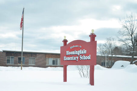
SARANAC LAKE — You might want to keep a few different coat options handy this weekend.
A hallmark of the season’s beginning to transition, the mercury is forecast to whipsaw over the next few days. Temperatures are slated to make a charge toward 40 degrees Fahrenheit before a strong cold front sweeps through late Saturday, according to the National Weather Service’s Burlington, Vermont office, which serves the Tri-Lakes region.
Along with an inch or so of snowfall Saturday night, this will usher in much colder air for Sunday. High temperatures are not expected to make it out of the teens. Temperatures will bottom out early Monday morning, with lows approaching the negative double digits. The bitter cold won’t last long, with highs expected to crest around freezing on Tuesday, and the mid-30s the rest of the week.
Though it’s still a bit of a way away and subject to change, for the last week, computer weather models have been consistently calling for a pronounced warm-up across the eastern U.S. toward the end of this coming week. The NWS’s long-term forecasts show between a 70% and 80% chance of above average temperatures for northern New York between March 7 and 13.
NWS Burlington Meteorologist Tyler Danzig said that there’s strong confidence in this warmup, even though it’s still a week or so away. That’s because it’s being driven by a large-scale pattern change in the jet stream’s flow, which he said computer models are more adept at picking up on in advance.
“There is pretty good confidence that by the second week of March, we will see an abnormal warm-up,” he said. “Patterns like this, in terms of where (jet stream) troughs and ridges generally set up, are pretty well handled by the models.”
In this case, a ridge — or a northward bulge in the jet stream — is predicted to set up over the eastern U.S. by the end of the first week or beginning of the second week of March as a large area of high pressure builds over Bermuda. High-pressure systems spin in a clockwise direction. Since its center is expected to be southeast of the Tri-Lakes, that will put this area in a southerly wind direction, pushing in relatively warmer air from the southern U.S.
Danzig said it’s too early to say exactly how warm temperatures could get, or if there will be flood concerns, which he said will hinge on how long the warm sticks around, if there will be any major rainstorms during that time and the dew points. Drier air tends to produce a slower snow-melting rate. Danzig added that those more fickle variables should come into focus toward the end of this coming week.
“It’s too hard to determine right now what the actual impacts will be from that,” he said.
While the warm-up is on the way, Danzig said that doesn’t mean the region is out of the woods quite yet as far as winter is concerned.
“There more likely will be a return back to more seasonable temperatures, and potentially some more wintery stuff, on the back side of this,” he said. “But again, a lot of that is still a bit uncertain at this point.”
Local News

LPHS to host concussion seminar Wednesday
Weekend roller coaster as mid-March warm-up looms
SARANAC LAKE — You might want to keep a few different coat options handy this weekend. A hallmark of the ...
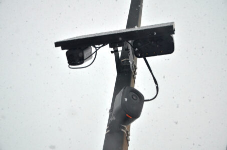
Saranac Lake halts controversial police cam installation
How a state grant derailed plans for Cascade Welcome Center
Snowshoer found dead in lean-to in Pharaoh Lakes Wilderness
SCHROON — A Florida man died from a self-inflicted gunshot wound to the head in a lean-to in the 44,400-acre ...