Saranac Lake sets record low temp Friday morning
LAKE CLEAR — When the mercury dipped to 22 degrees below zero at 6:05 a.m. Friday, Saranac Lake stood alone — for bitter or worse. It was, at that time, officially the coldest location in the contiguous United States.
It also broke the previous record low of minus 20 degrees, set in 2003, and will go down as the coldest temperature ever recorded here for Dec. 5, according to the National Weather Service’s Burlington, Vermont office, which serves the Tri-Lakes region. The historical record stretches back to 1903.
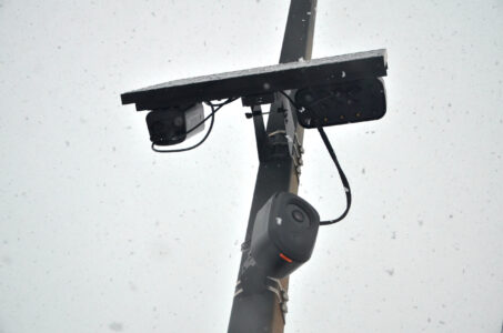
While the record is tacked to Saranac Lake, the official measurements are taken using NWS equipment stationed at the Adirondack Regional Airport (SLK), about five miles northwest of the village and in the immediate vicinity of the hamlet of Lake Clear.
The temperatures there tend to be a bit colder than in the village of Saranac Lake and most other nearby areas. That’s because of the airport’s geography. It’s both at a relatively high elevation, 1,663 feet, and sits in a bowl-shaped valley surrounded by yet higher terrain.
Under the right conditions — clear skies, minimal winds and a fresh snowpack — air tends to sink down as it cools off throughout the nighttime, allowing the coldest air to concentrate over the airport. This was the case on Thursday night and Friday morning, according to NWS Burlington Meteorologist Jessica Storm.
“We had some strong cold air advection behind a cold front and low-pressure system,” she said. “And then throughout the night, we were pretty much under fairly strong high pressure, which kept conditions very calm and clear, which allows the heat to radiate out more easily. That’s how you get the very cold nighttime temperatures.”
Despite hyper-specific local differences in temperature between Saranac LAke and Lake Clear, the record itself isn’t misleading. The previous low-temperature record was observed at the same location at SLK, making it a true “apples to apples” comparison.
Friday’s local record comes amidst an emphatic start to winter throughout the Adirondacks. The first week of December has seen well below average temperatures, according to data through Dec. 6 from SLK. The average temperature — including both daytime highs and overnight lows — has been 11.1 degrees Fahrenheit, a whopping 13.9 degrees below average for the first six days of the month. This comes on the heels of a November that was 2.9 degrees below average overall.
This year’s cold start to December — and forecasted continued cold into the middle of the month — bucks what’s been an increasingly warm month in recent years. Eight of the previous 10 Decembers have featured above-average temperatures, as measured at SLK, with 2018 being the last year on record to have a below-average figure for the entire month.
Storm said below-average temperatures are expected to persist over most of the next week. The only exception is Wednesday, when temperatures will warm to around average as the next weather system moves into the region.
Though daytime highs then are predicted to be around freezing, Storm said the precipitation type is expected to remain all-snow, with between 2 to 5 inches of snow eforecasted then, though these amounts could change as things get closer. Snow is expected to begin Tuesday evening, with a lull possible on Wednesday morning before the snow ramps up again for the afternoon, possibly making for a tricky evening commute.
Local News

Costume craziness at BrewSki
Forest ranger recalls saving hiker lost for two days in Dix Range

Back-to-back champions

LPHS to host concussion seminar Wednesday
Weekend roller coaster as mid-March warm-up looms
SARANAC LAKE — You might want to keep a few different coat options handy this weekend. A hallmark of the ...