Icy rain blows in
County emergency directors say limit driving through Tuesday morning
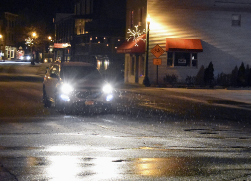
A car drives down Main Street in Saranac Lake Sunday night as sleet begins to fall. The National Weather Service released a winter storm warning until Tuesday afternoon. (Enterprise photo — Griffin Kelly)
There is a Winter Storm Warning in effect for the Tri-Lakes until Tuesday afternoon.
The National Weather Service station in Burlington, Vermont, predicted heavy mixed precipitation of snow, sleet and freezing rain for the southern parts of Franklin and St. Lawrence counties and the western part of Essex County. The warning went into effect Sunday night and is expected to end by 1 p.m. Tuesday.
Southern Franklin and Western Essex counties are expected to get 1 to 4 inches of snow and a quarter- to one-half inch of ice, the NWS said.
A wintry mix developed late Sunday evening and was expected to become widespread by Monday morning. That’s expected to lead into occasional snow and freezing rain showers by nighttime. The NWS predicts additional snowfall for Tuesday.
“The National Weather Service is normally pretty good with this stuff, so people should be prepared for some nasty weather over the next 48 hours,” Franklin County Emergency Preparedness Director Ricky Provost said in a phone interview Sunday.
Hazardous conditions will impact the Monday morning and evening commute, the NWS said.
Essex County Emergency Services Director Don Jaquish said, if possible, people should avoid traveling during the storm.
“The interstate, I-87, is not a good place to be at all when there’s ice,” he said in a phone interview Sunday. “All roads will be dangerous if there’s icing — any big hills like the one going into Keene (state Route 73).”
“We’re in for a fairly lengthy storm, so if you don’t have to travel, don’t,” Provost said.
On Sunday, Gov. Andrew Cuomo directed state agencies to pre-deploy winter storm response assets in preparation for potentially hazardous driving conditions throughout the mid-Hudson Valley, Capital Region, North Country and Mohawk Valley.
Jaquish said if you have to travel, make sure your car is capable of driving in the snow and has snow tires.
“Don’t be part of the summer tire club,” he said, “and all-season tires are definitely not snow tires.”
The NWS also expects the combination of snow and ice to cause scattered power outages and tree damage.
Jaquish said outages and downed trees occur more regularly in towns such as Schroon and North Hudson, where the wind whips through at high speeds.
“It can get up to 40 mph in some areas,” he said. “If there is an outage, people should call the 800 number for their utility provider, not 911.”
On Halloween, a rain and wind storm tore through many parts of the state. Schroon, North Hudson, Ticonderoga and Port Henry experienced flooding, power outages that lasted for multiple days and trees coming down after the storm had passed.
According to the NWS, the temperature in the Tri-Lakes is expected to stay between 20 and 30 degrees above zero during the storm. It also predicts winds below 15 mph.
“We shouldn’t have a real difficult time with heating,” Provost said. “It’s going to be cold but not severe. We always recommend people heat their homes safely. Carbon monoxide is a big issue in these events when people use generators — just make sure they’re in a well-ventilated area.”
Local News

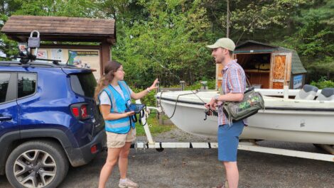
Constructing collaboration

Early-season paddlers
The pit and the potential for new housing

Authors to discuss ‘The First Adirondackers’ at John Brown Farm

Expect hunger to rise as new SNAP rules take effect