Winter storm expected to graze Tri-Lakes on Tuesday
Heavier accumulations expected in the Capital Region, New England
SARANAC LAKE — A fast-moving winter storm is forecast to bring significant snowfall to eastern New York and much of New England on Tuesday. While light to moderate accumulation is expected locally, the Tri-Lakes region will likely miss out on the bulk of the storm’s snow.
The National Weather Service’s Burlington, Vermont office, which serves northeastern New York, noted in its forecast analysis Sunday afternoon that things could still change, but it’s appearing increasingly likely that the snowfall bullseye will miss this area. Instead, that looks to stretch through New York’s Capital Region, southern Vermont, northwest Massachusetts, New Hampshire and Maine, according to NWS Burlington Meteorologist Maureen Hastings.
Those areas are expected to see between 8 and 12 inches of snow, with high-end totals approaching 18 inches in a few pockets. Travel there — including portions of the I-87, I-90 and I-95 corridors — is likely to be snarled for much of Tuesday, stretching into Wednesday.
“Numbers could change a little bit, obviously, but right now we’re relatively confident that northern New York will stay on the lighter side,” Hastings said.
Locally, she said the Tri-Lakes will likely see between 2 and 4 inches of snow, with mountain summits predicted to see between 4 and 6 inches. There will likely be a directional gradient to the snow totals, with generally lesser amounts to the northwest and greater amounts to the southeast.
The snow is expected to begin falling locally around dawn on Tuesday, continuing at a mostly light, but steady, clip throughout much of the day before starting to wind down during the early evening hours and fully coming to an end here by early Wednesday.
After a lull in impactful weather for Wednesday, an arctic cold front is anticipated to push across the region Thursday morning, making for a potentially tricky morning commute. That’s because there may be snow squalls accompanying the front’s passage.
A squall refers to a narrow, but intense, line of precipitation that quickly sweeps through an area. While generally short in duration — often moving through an area in less than 30 minutes — they pack a punch, with heavy snow combining with strong winds to create a period of reduced visibility, often under half a mile.
“That could be coming right around the morning commute,” Hastings said. “People need to be aware if they’re getting up and getting ready for work in the morning that there might be some changeable road conditions.”
Total accumulations on Thursday look to remain under a couple of inches. The real story, however, will be the temperatures that follow.
“It turns quite cold behind it, with temperatures Thursday night getting down below zero,” Hastings said.
It will also be breezy behind the cold front, with wind chill values late Thursday and early Friday morning between 10 and 15 degrees below zero anticipated. Daytime highs are expected to be stuck in the teens on Friday, before recovering back to the mid and upper 20s this coming weekend. Weather models are hinting at another coastal storm during that time, although it remains too far out to tell if it will have any impact locally.
Local News
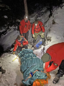
Tupper Laker rescued from Ampersand Mountain
Gaming commission: Don’t gift lottery tickets to those under 18 this holiday season
ALBANY — As the holiday season gets underway, the state Gaming Commission, state office of addiction services ...
Winter storm expected to graze Tri-Lakes on Tuesday
SARANAC LAKE — A fast-moving winter storm is forecast to bring significant snowfall to eastern New York and ...
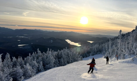
Sunset from the slopes

Alaska-Fairbanks wins Adirondack Invitational title
How much to borrow for 33 Petrova?
SARANAC LAKE — The village board dug down on Monday into the details of how the loans the village could take out ...