Tricky travel today
Storm expected to bring moderate accumulations; heaviest snow slated to fall late morning, easing by evening
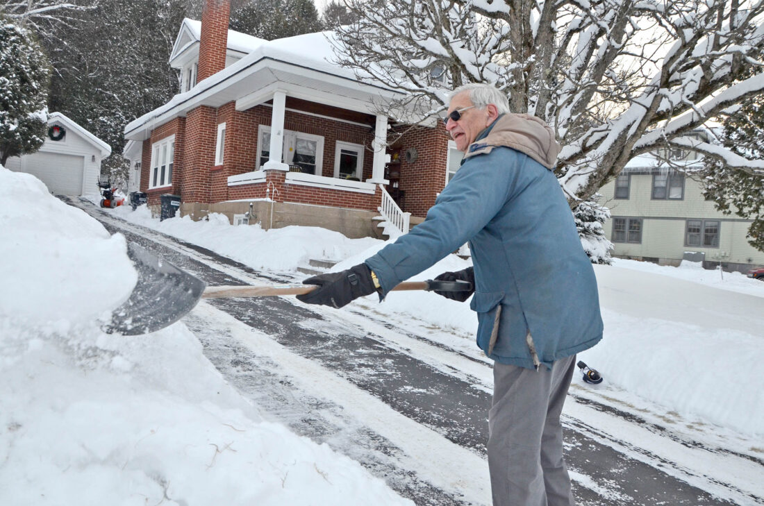
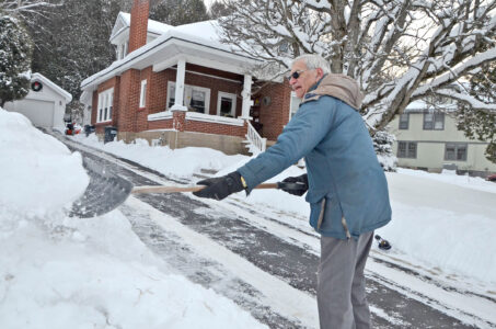
John Pozzi shovels the edge of one of four driveways he clears every time it snows on Tuesday. He said this winter is reminding him of the winters from the 1970s. He was clearing around six inches of snow from Sunday’s storm and was preparing for the three to seven inches forecast for Tuesday night and today. “I’m done with winter,” Pozzi said with a chuckle. His own driveway wasn’t even cleared yet. (Enterprise photo — Aaron Marbone)
SARANAC LAKE — A winter weather advisory is in effect for Franklin, Essex and St. Lawrence counties until 7 a.m. Thursday, as another snow storm rolls through the Adirondacks in what has been a cold and snowy start to the winter season.
The National Weather Service’s Burlington, Vermont office, which serves the Tri-Lakes region, is predicting between 3 and 7 inches of snow locally by Thursday morning. Generally lesser snowfall amounts are expected east of Lake Placid, as the storm path’s southwest-to-northeast direction will create a “snow shadow” effect in the Champlain Valley. As air moves down from the higher elevations of the Adirondacks, it warms slightly. The warmer air is, the more moisture it tends to retain, resulting in less snow falling from the sky.
North central and eastern areas of Essex County, including Wilmington, Jay and AuSable Forks — as well as much of Clinton County — are predicted to see between 1 and 3 inches of snowfall by Thursday morning.
The opposite effect will take place in the southern Adirondacks. There, air will lift as it moves past the relatively lower elevations throughout central New York. As it rises, it cools, causing it to hold less moisture, and subsequently leading to heavier snowfall. A winter storm warning — which is a more severe type of weather alert than a winter weather advisory — is in effect for Hamilton County and the northern portion of Herkimer County through 7 a.m. Thursday, where between 7 and 14 inches of snow are forecasted.
The winter weather advisories and winter storm warnings expiration times — which are current as of Tuesday evening — may be moved up or delayed as needed, based on how the storm plays out.
Throughout the Tri-Lakes region, the heaviest snow is expected to fall during the late morning and early afternoon hours, according to NWS Burlington Meteorologist Seth Kutikoff. He noted that steady moderate snow on both ends of that “heavy snow” window today could make for difficult morning and evening commutes.
Kutikoff said maximum snowfall rates with this event locally are expected to peak at between one-half to one inch per hour, gradually tapering throughout the afternoon. This will combine with winds that are forecasted to be between 10 and 15 mph to create, at times, visibility as low as half a mile today, he noted.
“We’re forecasting pretty steady breezes out of the south,” he said. “With gusts as high as 20 to 25 mph, and, of course, higher in the mountains. That should continue for much of the day.”
He added that winds are expected to shift to blowing out of the west and northwest tonight after the storm’s center passes by the region, with some gusts as high as 30 mph. Breezy conditions are expected to linger into Thursday, gradually diminishing into Friday.
The steadiest snow is expected to wind down during the evening, transitioning to scattered snow showers overnight and into Thursday morning. Kutikoff said these are expected to be most persistent across the northwestern Adirondacks and High Peaks region, where up to a few additional inches of light, fluffy snow is possible.
Kutikoff said colder air is set to move in on the heels of today’s storm, ushering in another period of well-below-average temperatures for the Tri-Lakes region. This follows last week’s record-breaking cold snap, where the Adirondack Regional Airport (SLK) in Lake Clear plummeted to 22 degrees below zero at 6:05 a.m. Friday, breaking the previous low temperature record of minus 20, set in 2003, while simultaneously posting the coldest recorded temperature anywhere in the contiguous United States at that time.
No records are anticipated to be broken with this next cold snap, though daytime highs and nighttime lows are expected to range from 10 to 20 degrees Fahrenheit below what is typical for this time of year for most of this week, after today, when temperatures will hover around what is normal.
“Beyond this event, it does look to be persistent cold, potentially very cold once we get to Sunday night and into Monday,” Kutikoff said.
Four of the first eight days of December featured below-zero low temperatures at SLK, where official meteorological observations for Saranac Lake are taken. The month has been 14.7 degrees Fahrenheit below normal through Monday, the most recent day that meteorological observations were posted for SLK as of press time.
Kutikoff said that after today’s snowfall, there are no other notable snowstorms on the horizon for the rest of this week, though there may be some scattered light snow across the area this weekend, which could produce minor accumulations.
Local News

APA’s top lawyer leaves as howitzer hearing looms
Report details accessibility of Adirondack trails
KEENE — A new report from the Adirondack Land Trust, “Ground Truthing Accessible Wildland Trails Across the ...
ACW to present Queer Lit Night at Hex and Hop Brewing
SARANAC LAKE — The Adirondack Center for Writing will host a Queer Lit Night at Hex and Hop Brewing in ...
Tricky travel today

Hochul signs some, vetoes nearly 50 bills amid year-end push
SLPD officer sues department for harassment, retaliation
SARANAC LAKE — A female Saranac Lake Police officer is suing the department, the village and the former police ...