December on track to finish as third coldest for Tri-Lakes this century
Modest snow storm set to drop 2-3 inches this evening
-
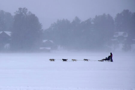
- A dog sled makes its way through a windswept Mirror Lake on Tuesday in the village of Lake Placid. This cold, wintry pattern is expected to persist into next week, at least. (Enterprise photo — Chris Gaige)
-

- Slick road conditions are through the Notch on state Route 86 near the town border between North Elba and Wilmington on Tuesday. Frigid, single-digit temperatures made it difficult for road salt to melt the day’s accumulating snow. Similar road conditions are expected tonight as a clipper system makes its way through the area, with 2 to 3 inches of snow expected. (Enterprise photo — Chris Gaige)
-

- Traffic weaves through the Notch on state Route 86 near the town border between North Elba and Wilmington on Tuesday. Frigid, single-digit temperatures made it difficult for road salt to melt the day’s accumulating snow, leading to slick roads. Similar road conditions are expected tonight as a clipper system makes its way through the area, with 2 to 3 inches of snow expected. (Enterprise photo — Chris Gaige)
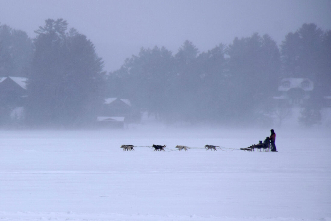
A dog sled makes its way through a windswept Mirror Lake on Tuesday in the village of Lake Placid. This cold, wintry pattern is expected to persist into next week, at least. (Enterprise photo — Chris Gaige)
SARANAC LAKE — At least it’s consistent.
December is on track to end no differently than how most of the month has played out here, weather-wise. Temperatures will be far below average with a fresh coating of snow as a clipper system pushes through the Tri-Lakes region. It’s predicted to drop a fluffy 2 to 3 inches of snowfall this evening and tonight, then usher in a reinforcing shot of frigid Arctic air that will likely keep the mercury stuck in the single digits for New Year’s Day.
Temperatures at the Adirondack Regional Airport in Lake Clear — where official measurements are taken using National Weather Service equipment — are running 5.2 degrees Fahrenheit below normal for the month, according to data through Monday, the most recent day it was available. The final monthly figure is expected to trend down a bit from that, given Tuesday and today’s especially cold weather.
Regardless, the 15.8 degrees F monthly temperature average through Monday is the third coldest December at the airport this century, according to NWS data. Only 2017 (11.9 degrees F) and 2000 (11.6 degrees F) experienced colder Decembers.
Although today’s storm is not much snow by North Country standards, those on the road for New Year’s Eve should plan accordingly. Single-digit temperatures throughout the event will reduce the efficacy of road salt, leading to potentially slick roads and sidewalks, according to NWS Burlington Meteorologist Eric Myskowski.
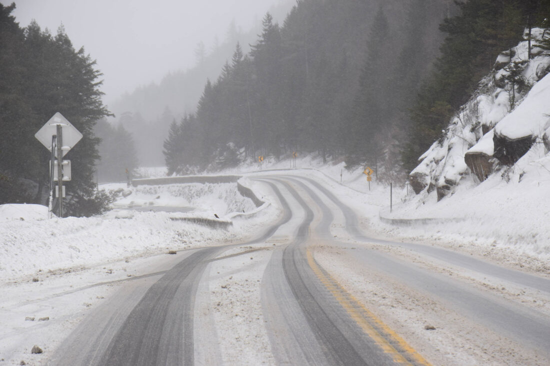
Slick road conditions are through the Notch on state Route 86 near the town border between North Elba and Wilmington on Tuesday. Frigid, single-digit temperatures made it difficult for road salt to melt the day’s accumulating snow. Similar road conditions are expected tonight as a clipper system makes its way through the area, with 2 to 3 inches of snow expected. (Enterprise photo — Chris Gaige)
“There’ll be a break (this) morning before the clipper starts to move in for the afternoon,” he said. “Looks like it’s going to start off as some light snow mid- to late-afternoon and become a little more light to moderate in the evening to a couple hours after midnight.”
Myskowski added that snowfall rates look to be slightly more robust in the central and southern Adirondacks, closer to the storm’s track.
Clipper systems originate over western Canada and generally move southeast through the upper Midwest, Great Lakes and Northeast. Aptly named after the clipper sailing vessels, these storm systems are fast-moving and form over land, which tends to limit overall snowfall accumulations relative to nor’easters or lake effect snow, which both often impact an area longer and have more moisture to deposit.
The lake effect machine has been cranking for parts of central New York and the Tug Hill region, with parts of Oswego, Lewis and Jefferson counties expected to see more than four feet of snow throughout this week. The lake effect is expected to fire up again after the clipper departs, favoring the same areas for accumulation. Though the Tri-Lakes and surrounding mountain summits may pick up a fluffy coating through the weekend from a stray band or two.
Myskowski said this nickel-and-dime snowfall accumulation regimen is expected to continue, with frequent chances for light to sometimes moderate snow — keeping snow removers busy — without any major snowstorms on the horizon, at least for now.
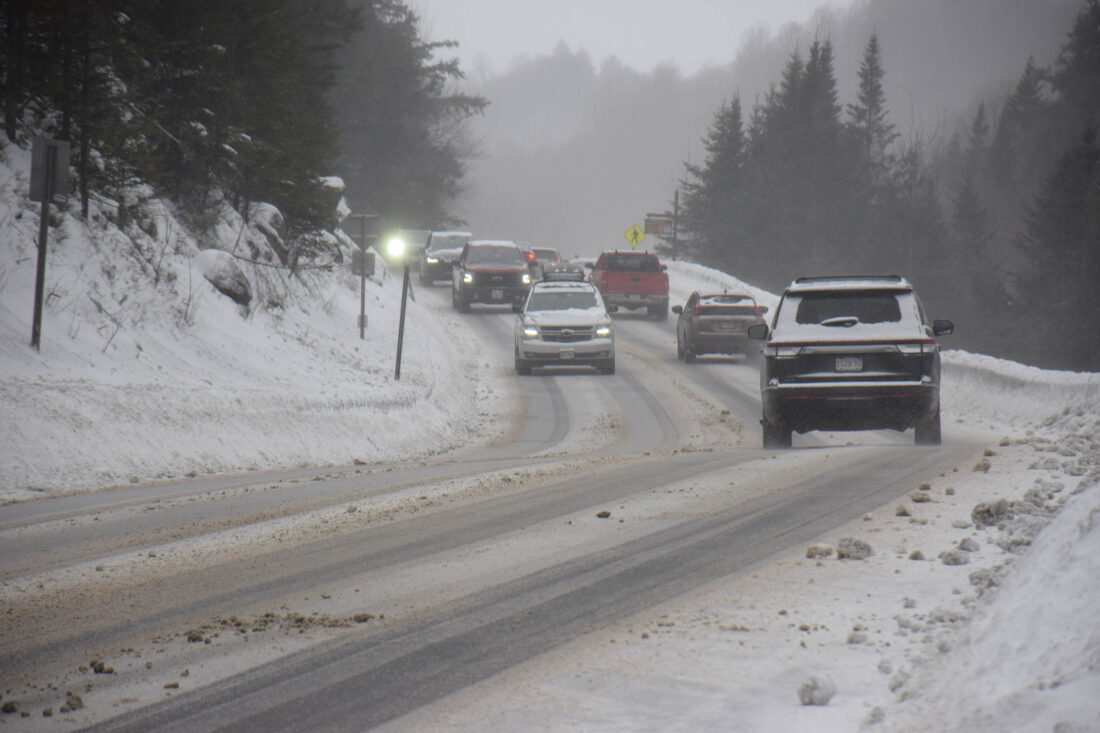
Traffic weaves through the Notch on state Route 86 near the town border between North Elba and Wilmington on Tuesday. Frigid, single-digit temperatures made it difficult for road salt to melt the day’s accumulating snow, leading to slick roads. Similar road conditions are expected tonight as a clipper system makes its way through the area, with 2 to 3 inches of snow expected. (Enterprise photo — Chris Gaige)
He said this setup should continue “well into next week,” and while there are some indications further out in the weather models after that of warmer incursions, it’s too far out to consider those with any reasonable degree of accuracy. Myskowski added that there have been a few times in December where models have shown similar pattern changes in the long-term, only to eventually back off and keep the cold in place.
“As we’ve gotten closer to the events, it’s ended up being colder than what the longer-range models originally had,” he said. “I wouldn’t be surprised if that’s indeed the case here, but it’s kind of early to see.”
Local News
December on track to finish as third coldest for Tri-Lakes this century

Remembering Eleanor Sweeney

Bridging classroom and career
Cashman appointed chair of NY-Canada Task Force
ALBANY — Assemblyman Michael S. Cashman is settling into his new role in the state capitol ahead of the ...
Roller coaster day of weather for Tri-Lakes
SARANAC LAKE — Winter is showing no signs of slowing down. Another mixed precipitation storm, accompanied by ...
