Early winter storm slamming northwest Adirondacks
Modest accumulations locally through this evening
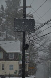
SARANAC LAKE — A winter storm warning remains in effect until 7 p.m. this evening for southern Franklin, southeastern St. Lawrence and western Clinton counties as snowfall totals of up to 18 inches are forecast. This combines what fell on Sunday with additional snow expected through today. There’s a catch, though.
Not all of the warning areas are expected to see that much accumulation, or even anything close to it. This includes the Tri-Lakes region, which is expected to receive 3 to 6 inches of snow between Sunday afternoon and this evening, according to the National Weather Service’s Burlington, Vermont office, which serves northern New York.
NWS Burlington Meteorologist Tyler Danzig said this type of weather system has a sharp gradient in snowfall, with a narrow axis of heavy accumulations and a rapid decrease outside it. That axis is north and west of the Tri-Lakes. This is primarily due to the storm’s predominant wind direction, which is being driven by the low-pressure storm that brought rain, sleet and freezing rain Saturday evening.
The center of that low pressure has now moved northeast into the Canadian Maritimes. Since low-pressure systems spin counterclockwise, northern New York is experiencing a northwest wind flow today, Danzig explained.
“Those northwest winds are ushering in cold air advection,” he said. “That wind is blowing right into the western faces of the northern Adirondacks. Through a process called ‘orographic lift,’ as air is run into the mountains and then forced upwards, it condenses into a cloud and precipitates as it runs up.”
Danzig said that under this setup, the heavy snowfall is “very localized” to the terrain that runs upward from the St. Lawrence Valley. Once the rising levels off, the snowfall tapers. It’s not so much the high elevations that see the greatest snowfall, but rather, where the greatest change in elevation is coming out of the St. Lawrence Valley. In this case, that’s north or west of the Tri-Lakes region.
The snowfall bullseye arcs northward from Big Moose and Stillwater in northern Herkimer County to Wanakena, Star Lake, Cranberry Lake and Stark in St. Lawrence County. In Franklin County, the bullseye extends northeast from the St. Regis Falls and Santa Clara areas to Malone, Owls Head and Chateaugay, extending into the Chazy Highlands and Ellenburg areas in western Clinton County.
Those areas are all expected to see 8 to 12 inch storm totals, with some isolated higher amounts up to 18 inches possible. Travel will be hazardous there throughout today. Danzig said this includes state Route 3 west of Piercefield, most of the state Route 56 and state Route 458 corridors, state Route 30 north of Paul Smiths and U.S. Route 11 between Moira and Mooers.
–
A bit of a twist
–
Although orographic lift, also known as upsloping, is a common feature of weather in mountainous regions like the Adirondacks, this particular storm’s setup is somewhat unique, noted Scott McKim, a meteorologist and the science manager at the Atmospheric Sciences Research Center’s Whiteface Mountain Field Station.
He said that with upsloping weather events in the Adirondacks, it’s usually the higher mountains, such as the High Peaks, that tend to capture the most snow, not the peripheral “dome” of rising terrain on the northwest edge of the Adirondacks that lifts out of the St. Lawrence Valley.
This time, the dynamic is flipped. Although the High Peaks are still forecast to receive more snow than the surrounding lower elevation areas, such as the Tri-Lakes region, they are not the bullseye for this storm. McKim said this is because of how the winds at different levels, or elevations, of the atmosphere are behaving.
He said the wind just above Earth’s surface is blowing stronger than usual for these types of storms. The greater wind forcing causes the moisture to be wrung out — and deposited as snow — sooner after the air starts lifting out of the St. Lawrence Valley than is typical. This leaves it drier by the time it gets to the Tri-Lakes and High Peaks regions.
“Most of the (wind) flow is so close to the surface that all you need is a little bit of uplift — that little bit of ascent and cooling — then you’re going to get snow to fall out,” he said.
Under a conventional setup with the near-surface winds a bit less prominent, more moisture would be carried into the Adirondack’s interior. This results in relatively heftier accumulations there, and relatively lesser accumulations in this storm’s bullseye area. McKim said this peculiarity has to do with how this past weekend’s low-pressure system is tracking now that it’s northeast of the region.
“It’s an artifact of where the surface low (pressure system) is, and then it’s transitioning into a coastal low and the angle from which it’s pulling all the cold air on the back side of the low is kind of just perfectly orthogonal to the lift of the northwest-facing of the Adirondacks,” he said. “It’s mainly a geography scenario coupled with the synoptic setup of the low.”
–
Local snows
–
With the Tri-Lakes still forecast to rack up some accumulations through this evening, Danzig said travel could still be slick locally, especially on secondary roads. A winter weather advisory, which is less severe than a winter storm warning, is in effect for western Essex and Hamilton counties until 7 p.m. this evening.
Storm totals between 3 and 6 inches are expected in Lake Placid, Ray Brook, Wilmington and Long Lake. Danzig said higher totals are likely for Whiteface Mountain and the other Adirondack High Peaks, even as they are out of the primary orographic lift zone for this particular storm. He added that these mountain summits could see as much as 8 inches, with snowfall amounts decreasing with elevation.
The winter storm warning and winter weather advisory expiration times are valid as of press time Sunday evening. They may be cancelled early or extended as needed, depending on how conditions play out today.
–
Going forward
–
Quiet weather is expected Tuesday, Wednesday and Thursday across the Tri-Lakes as high pressure builds in on the heels of today’s snow. Temperatures are forecast to gradually warm up throughout the week, remaining below freezing on Tuesday before daytime highs above freezing are expected the rest of the week, according to Danzig.
“By the weekend, we have a really stark warmup as we have our next system moving in Friday afternoon,” he said. “That looks to be a mainly rain event for the entire region — outside of the immediate summit (areas) — where temperatures Friday could reach into the mid to upper 40s. So, we will see some snow melt by the end of the week.”
For skiers and snowboarders, this unfortunately coincides with the anticipated reopening of the Whiteface Mountain ski area. The ski center is set to reopen on Friday for season pass holders and on Saturday and Sunday for everyone, weather and conditions permitting.
Whiteface opened for the season this past Saturday. It was scheduled to operate on Sunday as well, though high winds forced the lifts to close after only an hour or so of spinning in the morning. The ski area will remain closed today through Thursday, as well as most of next week, before daily operations are set to begin for the season on Friday, Nov. 28.


