Statewide burn ban in effect as drought drags on
Lowest water levels on Champlain since 2016, little relief in sight
SARANAC LAKE — It’s not quite a record drought yet, but things are headed that way, with little change in the conditions expected through mid-October, according to the National Weather Service’s Burlington, Vermont office, which serves the Tri-Lakes area.
NWS Burlington Meteorologist Tyler Danzig noted that high pressure, which tends to keep storms away, is expected to remain in place over the area through Tuesday morning.
“There are no precipitation chances, at least over the next several days,” he said on Thursday.
The high pressure is also expected to usher in warmer air from the south, with temperatures running 10 to 20 degrees Fahrenheit above average today and Sunday, before more seasonable temperatures return later next week.
Gov. Kathy Hochul issued a temporary statewide burn ban on Thursday as a result of the drought and warm temperatures creating an increased fire risk. That will remain in place until at least Oct. 15, when it will be reevaluated, and possibly extended if there’s no improvement in the conditions then.
“The ongoing nice weather is great for watching fall foliage or gathering with friends, but it also presents a higher risk for fires that put homes, businesses and our brave first responders at risk,” Hochul said in a statement. “Many regions are already in a drought watch or warning due to the dry conditions, and with the fire risk rising in some parts of the state, it is important to keep everyone safe by implementing this temporary burn ban.”
The burn ban prohibits the starting of outdoor fires for purposes of brush and debris disposal, as well as all uncontained fires, including campfires, and open fires used for cooking, according to the statement.
Backyard fire pits and contained campfires less than three feet in height and four feet in length, width, or diameter are allowed, as are small, contained cooking fires. Burning garbage or leaves is already prohibited year-round.
Since the beginning of August, state Department of Environmental Conservation Forest Rangers have responded to 64 wildland fires across the state. Fires may become serious, and controlling them is difficult unless attacked successfully while still small. The Adirondacks are currently at a high level of fire danger. The DEC’s statewide fire danger map, which is updated daily, is available at tinyurl.com/59smywfc.
In addition to the dry weather, the heat and low humidity are elevating the wildland fire risk. The normal daytime high for Saranac Lake is 60 degrees Fahrenheit today, and 59 on Sunday, with a normal low of 36 for both days, according to NWS data. This is based on a 30-year average temperature observation from 1991 through 2020.
Saranac Lake’s record high for Sunday is 83 degrees, which was set in 2023. Though it’s not expected to be broken as of press time Friday, this year is slated to give the record a run for its money. Sunday’s forecasted high is 80.
Danzig said that this warmth should come to an end when a cold front is expected to cross the Tri-Lakes area Tuesday afternoon.
That cold front is expected to bring some rain. While Danzig said anything is better than nothing, it’s not looking like it will be enough to put a dent in the drought. Computer forecast models are showing between 0.3 and 0.5 inches of rain Tuesday afternoon into Wednesday, though model data is just one tool meteorologists use to develop a rainfall forecast, and Danzig said it was too early to accurately predict that.
One caveat he added was that computer models have historically overestimated incoming rainfall for regions that have been in a prolonged drought.
“What we like to say here at the office is, ‘when in drought, leave out,'” Danzig said. “Models tend to be a little ambitious on precipitation when in drought. Additionally, precipitation moving into an area that has been persistently in drought is hard to … get into the area, just because of how dry the air is.”
Danzig added that beyond the cold front, there’s not much else in the way of drought relief as high pressure is expected to return to close out the week, and there are no signs, for now, of any other significant rainstorms on the horizon.
The Tri-Lakes region is currently under either a moderate or severe drought, according to the U.S. Drought Monitor, with conditions generally drier to the east. Almost all of the Northeast is under some sort of drought status, with the worst conditions in parts of central Vermont, New Hampshire and Maine.
The U.S. Drought Monitor is a weekly report that tracks drought conditions across the country, using a variety of factors. It’s released in part by the National Oceanic and Atmospheric Administration, under which the NWS is also organized. To view the current ratings and map, as well as ones from past weeks, visit tinyurl.com/3yxa3xvp.
“The map did not change at all from last week to this week; we pretty much stayed status quo,” Danzig said. “We had some rain last week that was beneficial, but didn’t really put a dent into the drought itself, so the drought conditions kind of just persisted, but didn’t degrade or improve at all.”
Danzig said the last time things were this dry was 2016. Stream flows and lake levels offer a historical perspective on how severe the drought is, as some have observation data running back decades. Danzig said that’s the last time Lake Champlain’s water surface elevation was as low as it is now, around 93.5 feet.
“This isn’t a record-breaking drought, but we are nearing some of those conditions,” he said.
Local News
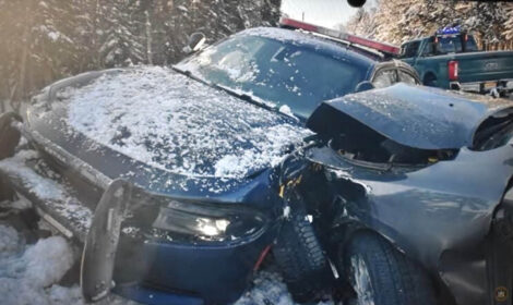
Close call: State trooper struck by vehicle in Duane
Assembly GOP outlines plan to cut energy bills
ALBANY — To help New Yorkers afford their energy bills, state Assembly Republicans want to provide $2 billion in ...
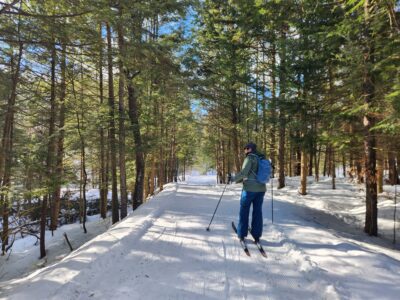
Adirondack Land Trust to host meet-and-greet at BREIA Trails
Historic Saranac Lake launches new wiki website
SARANAC LAKE — Historic Saranac Lake has moved its wiki website of local history to a new platform that is more ...
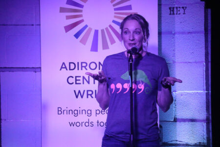
ACW Fact or Fiction storytelling event is back