North Country tornado? Not quite, NWS says
-

- A portion of a storm cloud touches down near Vermontville on May 21. Though it looks like a tornado, it was likely a “scud” cloud, which resembles a cyclone but is not hazardous. (Provided photo — Heather Mason)
-

- A massive wall cloud looms over Vermontville on May 21. In the bottom left corner of the cloud, a portion can be seen touching down. Though it looks like a tornado, it was likely a “scud” cloud, which resembles a cyclone but is not hazardous. (Provided photo — Heather Mason)

A portion of a storm cloud touches down near Vermontville on May 21. Though it looks like a tornado, it was likely a “scud” cloud, which resembles a cyclone but is not hazardous. (Provided photo — Heather Mason)
VERMONTVILLE — Marc McIntosh and Heather Mason were taking their new truck out for a drive on Norman Ridge on May 21 when they noticed a powerful storm developing in a massive, dark wall cloud over the fields.
After pulling over to take in the impressive sight, the couple noticed a portion of the cloud quickly stretching toward the ground. Within a minute, it touched down on the ground, briefly connecting Earth and sky, before dissipating just as soon as it arrived.
It looked like a tornado, but a meteorologist with the National Weather Service said it was likely a “scud” cloud fragment.
McIntosh said he’s never seen anything like that in his life. He said a woman rode by on her bicycle who said she was from Iowa and told them the larger storm mass looked like a stereotypical wall cloud.
“She’d know better than most,” he said of the Midwesterner.

A massive wall cloud looms over Vermontville on May 21. In the bottom left corner of the cloud, a portion can be seen touching down. Though it looks like a tornado, it was likely a “scud” cloud, which resembles a cyclone but is not hazardous. (Provided photo — Heather Mason)
Mason captured the fleeting and rare phenomenon on camera.
The Enterprise shared this photo with National Weather Service Meteorologist Matthew Clay from the NWS Burlington, Vermont station for analysis.
“This is an incredible image by the photographer,” Clay said. “It’s not everyday you get to see such textbook storm structure up in the Adirondacks.”
He provided an NWS radar snippet from 5:05 p.m. that day, showing major activity in the Vermontville area, and a pocket of intense rain at the center — reaching up to 65 dBZ, a measure of precipitation.
“We noticed the doppler radar was picking up winds around 35 mph with the storm as it moved through the area but couldn’t find any signs of rotation associated with the storm,” Clay said.
He said the base of the cloud in the photo looks like it could support a “brief tornado” but added that that was unlikely because of the lack of rotation caught on radar.
Clay assessed that this cloud was likely a “scud,” which stands for “Scattered Cumulus Under Deck.” These are cloud fragments which resemble tornadoes in shape, but without the actual cyclone effect.
“They typically look ominous when they are completely innocuous,” Clay said.
McIntosh said he did see swirling in the cloud as it touched down, and that it appeared to potentially be two clouds joining together.
“I think there’s so much topography in the area that it just broke apart,” he said.
Clay also said the photo could potentially show a small portion of the storm “collapsing” with a mix of rain and wind falling to the ground. He said this can create swirls and “weak rotation” as it hits the ground.
McIntosh said the photo was taken looking to the East from Norman Ridge Road over Fletcher Farm Road, so he estimated it touched down on the Franklin Falls Flow. There were low winds where he and Mason were and the sky was very dark.
Shortly after this rare occurrence, McIntosh said the thunder, lighting kicked up and they thought “We gotta get off the top of Norman Ridge here.”
He said they picked a good time to go for a drive.
Local News
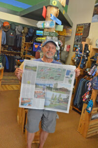
Paddling publicity
Hochul, McDonald frustrated with state Education Department
ALBANY — As hospitals across New York and the nation face the possibility of steep revenue drops thanks to ...

Review board hears concerns about Placid dispensary

Village board tables peaceful assembly law
‘Playing in the Road’
Catherine Edman retires as North Elba budget officer
LAKE PLACID — The town of North Elba is seeking a new budget officer as Catherine Edman wraps up a little over ...