Ausable River restored to cope with climate change

Ausable River Association Executive Director Kelley Tucker is pictured here in the field a few years ago. (Provided photo — Ausable River Association)
Ten years ago, Hurricane Irene dumped nearly a foot of rain in sections of the Adirondacks. Rivers and towns were flooded and roads and bridges were ripped apart. One of the rivers hit hardest by Irene has since been re-engineered to handle more extreme storms.
Along a stretch of the Ausable River north of Wilmington, tall pine trees tower over one bank, on the other are little yellow and white wildflowers and green bushes and shrubs. Whiteface Mountain rises up in the distance. This place is known as the ‘dream mile.’
“It’s pretty gorgeous,” says Kelley Tucker, standing along the riverbank. “Look, you’ve got a wetland and a flood plain and a river.”
Tucker is the executive director of the Ausable River Association (AsRA) and recently led a tour along sections of the river that the AsRA has helped restore in recent years. At this section, Tucker prompts the group with a dilemma.
“There’s a little problem,” says Tucker. “The problem’s been here since about 1780. You’re standing on it. It’s the road.”
If the road wasn’t here, this river could flood from time to time, as rivers normally do, no big deal. But when you build roads and homes along these wild rivers, flooding becomes a problem, one that can upend people’s lives.
That’s exactly what happened a decade ago during Hurricane Irene, when the Ausable overflowed and flooded towns like Keene and Jay. But Tucker says the Ausable River had already been eroding for years. Irene just took advantage of that.
“There was nothing new in Irene for the river,” says Tucker. “It was just like, ‘Oh, vulnerability. I got this.'”
The floodwaters from Irene and other storms in the past had widened the banks of the Ausable. Deep pools where trout used to gather filled up with rocks and sand. When a river gets wider and more shallow, it has a harder time moving rocks and other debris downstream, which leads to more destruction during a flood.
The Ausable had become that kind of wide, shallow river after Irene. “It was flat and still and silent,” says Tucker.
In 2015, a few years after Irene, the local landowners here partnered with the Ausable River Association. They wanted the trout to return, they wanted a river that could handle more flooding. Tucker and her team got to work.
Over the next three summers, a crew re-engineered this section of the Ausable. They dug out the middle of the river to deepen it and built up the sides to make it more narrow. They even placed huge rocks and tree stumps in specific parts of the river to help direct the flow and provide habitat for fish.
Now what you see standing on the banks of the dream mile is what looks like a wild, free-flowing river, but Tucker says this place has human engineering all over it.
“Every single thing up there to the tall tree in the bend where the island is, we put here,” says Tucker. “That nice riffle? That’s ours.”
Since Hurricane Irene, the Ausable River Association has restored dozens of sites along the river. They’ve taken on big projects like the dream mile, but they’ve also removed dams, widened culverts, and retrofitted bridges.
Rivers like the Ausable would naturally restore themselves after major floods, but that could take centuries, not just a few summers. Tucker sees these projects as a balance between human needs and environmental realities.
“We want public safety,” says Tucker. “We like our infrastructure not to be affected so profoundly by flooding. So our response tends to be, ‘What can you move and what is essential?'”
In some places, moving rocks and riverbeds is easier than moving roads and homes. The next stop on the tour is a section of the Ausable ten miles east, in Jay.
Huge yellow trucks slosh through the water, moving dirt and rocks from the middle to the outer banks. Here, too, the river had gotten wider and shallower since Irene and had split into two channels.
Gary Henry from the Ausable River Association says they’re engineering it so the second channel is just used for overflow.
“Anything more than your average annual high flows,” says Henry, “the water will be able to come over this and use this side-channel for relief and get up onto its floodplain and dissipate some of its energy before it would go downstream and ravage some town.”
The kinds of storms like Irene, which can ravage towns, are rare here, but climate change is changing that and the cost to repair roads and bridges will continue to climb. The restoration work on the Ausable is an attempt to preempt that, so that Irene-like storms or just annual spring thaws don’t bring the destruction they have in the past.
Kelley Tucker says they’re getting there, but the work is far from over. One of the last stops on the tour is just a few miles south in Upper Jay, which got hit really hard during Irene.
“This was sort of the epicenter. The road was chewed up in several places because the water came around this way, both sides,” says Tucker, pointing upriver along the banks.
The river here is also really wide and shallow and there’s a bend in the river that’s aimed right at the road. Tucker points to the big boulders on the opposite bank.
“I think of that as the cannonballs aimed at Ausable Forks if we don’t get this job done.”
Tucker has applied for a grant with the DEC and has backing from the US Fish and Wildlife Service.
This river is still at least a decade away from where Tucker would like it be, but she says once these sites along the Ausable are strengthened and restored, the work will pay off.
“The key piece to the puzzle for us is always creating that self-sustaining stream that can reach its potential and can do its own maintenance, rebuilding its own native forms,” says Tucker. “We think that’s the key, that’s the low-cost key in the long run.”
By investing in this river now, Tucker says, it will be stronger and more resilient against major storms, ones that climate change will bring to the Adirondacks in the decades to come.
Local News
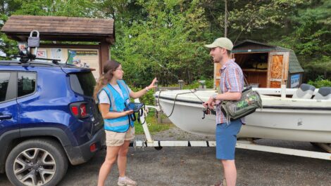
Paul Smith’s College Adirondack Watershed Institute urges boaters to help stop aquatic invasive species this summer
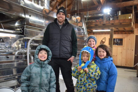
Lake Placid sugarbush sees best week yet
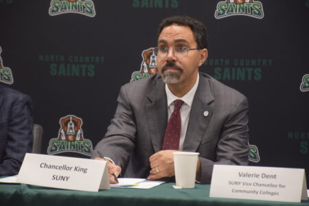
SUNY chancellor talks Reconnect program at NCCC

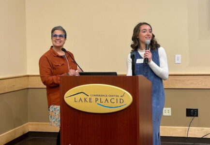
North Country students attend women in law event
WCSC awards scholarships to locals
SARANAC LAKE — The Women’s College Scholarship Club is accepting applications for $3,000 scholarships which ...